
The Weather Pattern will Remain and Hot Dry for the Next Couple of Weeks
AUG. 14, 2026
Very few changes in the weather can be expected over the next week as our region remains locked in a persistent hot and dry weather pattern. A strong ridge of high pressure in the middle and upper atmosphere is forecast to remain over Texas and the south-central U.S. through the period, keeping the atmosphere stable and very hot. Long-range forecast solutions indicate this pattern will likely continue through the end of the month, with no appreciable change in the daily high temperatures.
Friday will offer up a low chance for a few spotty rain showers for areas along and east of Interstate 35 as an area of enhanced tropical moisture spreads inland along the middle and upper Texas. This moisture will be running into a large area of sinking air and much of it will diminish. However, conditions may allow for a few spotty rain showers to develop all the way inland to the I-35 corridor. The probability for rain across this area will be less than 20 percent. For areas that happen to see rain, totals should average less than a quarter inch. Otherwise, Friday’s weather is forecast to be sunny and continued hot. High temperatures are forecast to be near 98-100 degrees across the Hill Country and Central Texas regions, and in the middle 90s across the coastal region.
Friday’s analysis showed the center of the heat dome located over the eastern Gulf. The center is forecast shift northwest late Friday into Saturday, arriving over North Texas and southern Oklahoma Sunday into next week. For the second half of next week, the heat dome center is forecast to set up across eastern New Mexico and the Texas Panhandle. With the center moving close to Central Texas next week, the temperature is forecast to remain quite hot with more persistent triple digit temperatures.
- Daily high temperatures Saturday through next Friday are forecast to be near 98-100 degrees across the Hill Country, near 99-103 degrees across Austin and Central Texas, and in the upper 90s across the coastal plains
Forecasts for the week of August 24th unfortunately call for little change as our region looks to remain under the influence of the heat dome. Daily high temperatures are predicated to remain near 98-101 degrees. No rain is forecast.
Do not underestimate the effects of heat stress when working or spending time outdoors for extended periods. Make sure to keep protecting yourself, your loved ones, and pets safe from the heat. Reduce or change the time spent outdoors to cooler times of day, increase the time and access to air-conditioned spaces, and always check the car seats before departing your vehicle.
Tropical Weather Outlook
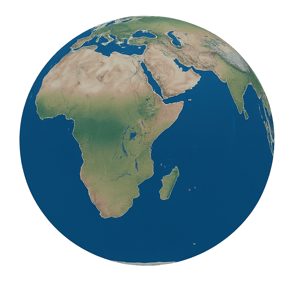
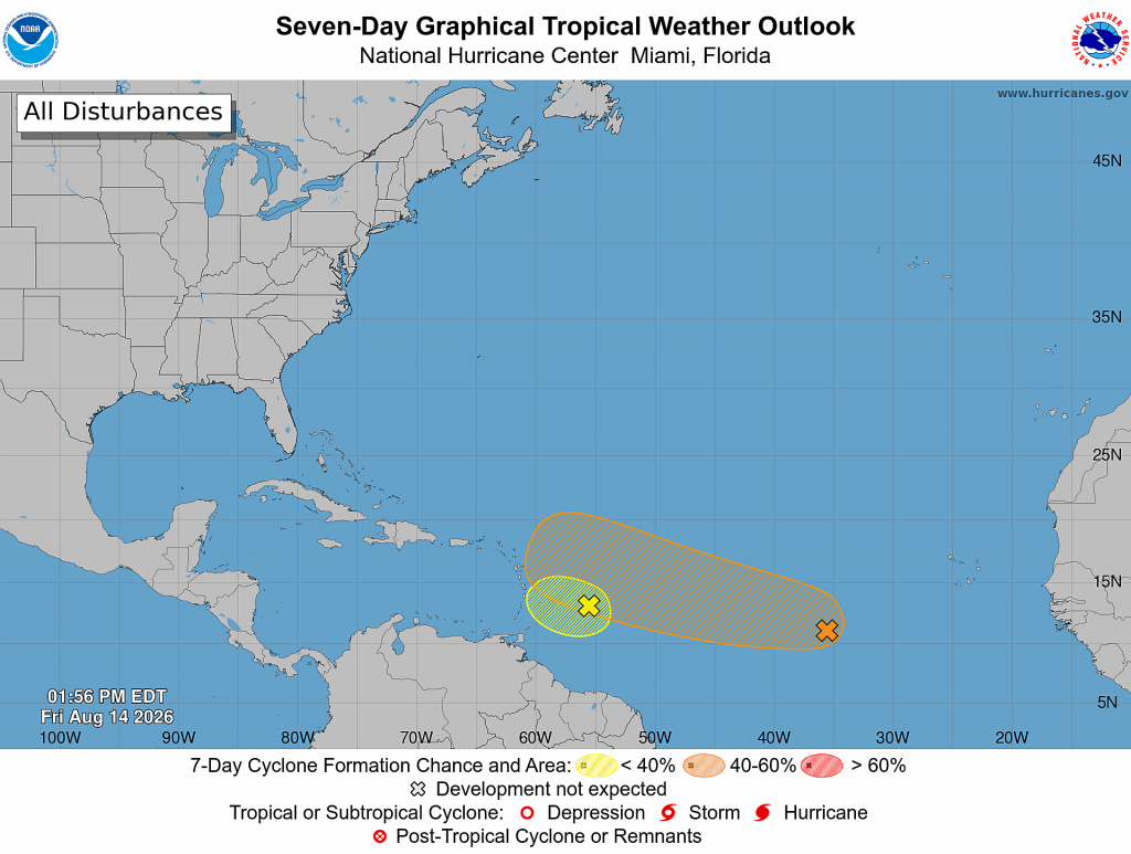
Weather conditions are currently quiet across the Gulf and the Caribbean Sea. From the western coast of Africa to the central tropical Atlantic, satellite images show a wave train of tropical waves. However, the environment across this region doesn’t appear supportive of tropical development. There is too much stable/sinking air across the Eastern Atlantic, and considerable wind shear across the central and western Atlantic. National Hurricane Center forecasters are currently monitoring two tropical waves, but neither one appears to pose a threat to the Gulf region.
The first wave was located over the central tropical Atlantic, about 350 miles east of the Windward Islands. It is producing gusty winds and a large area of showers and thunderstorms. This system is moving into a region of increasing upper-level winds and dry air, and the potential of development continues to decrease. Even though development is unlikely, gusty winds and areas of heavy rain are possible across portions of the Lesser Antilles Friday night and Saturday. NHC forecasters are giving this system just a 10 percent chance for tropical development over the next seven days.
Across the eastern tropical Atlantic, a tropical wave was located more than 1000 miles west of the Cabo Verde Islands and was producing an area of disorganized showers and thunderstorms. Environmental conditions are forecast to be generally conducive for gradual development, and a tropical depression could form this weekend or early next week while the wave moves westward or west-northwestward across the central tropical Atlantic. However, the system could encounter strong upper-level winds next week, decreasing its chances for development. NHC forecasters are giving this system a 40 percent chance for tropical development over the next seven days.
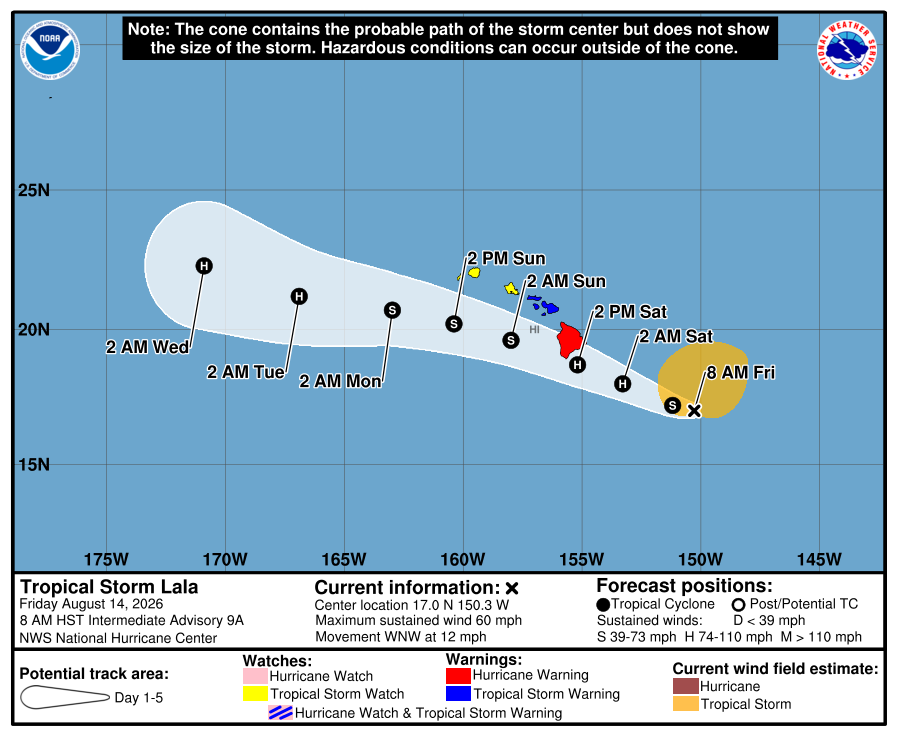
Watches and Warnings Issued for the Hawaiian Islands Due to Tropical Storm Lala
A Hurricane Warning is in effect for…
* Hawaii County
A Tropical Storm Warning is in effect for…
* Maui County, including the islands of Maui, Lanai, Molokai and
Kahoolawe
A Tropical Storm Watch is in effect for…
* Oahu
* Kauai County, including the islands of Kauai and Niihau
As of 1 pm CDT Friday, the center of Tropical Storm Lala was located near latitude 17.0 North, longitude 150.3 West. Lala was located about 580 miles east-southeast of Honolulu, Hawaii and moving toward the west-northwest near 12 mph. This general motion is expected to continue, taking the core of Lala near the Big Island of Hawaii on Saturday and then south of the smaller islands on Sunday.
Maximum sustained winds remain near 60 mph with higher gusts. Steady strengthening is forecast, and Lala is expected to become a hurricane when it approaches the Big Island Saturday.
Tropical-storm-force winds extend outward up to 205 miles from the center.
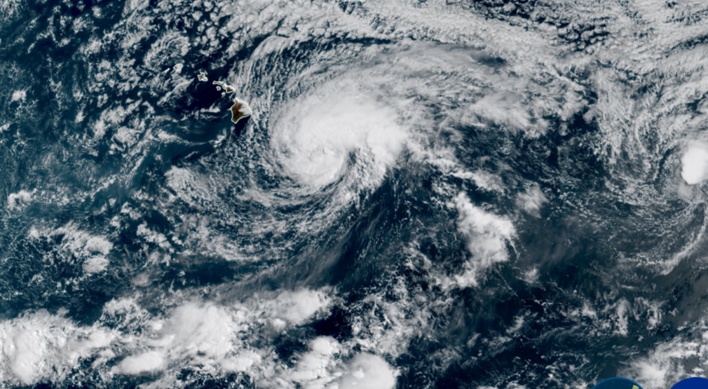
NOAA/Colorado State University/CIRA 08/14/2026 2:10 pm CDT
August El Niño Update
On Thursday, NOAA’s Climate Prediction Center issued its monthly update on ENSO. In the update, CPC forecasters indicated El Nino continues to strengthen as more warm water is flowing east from the western Pacific. Sea surface temperature anomalies now exceed more than 2.0°C in the eastern equatorial Pacific.
The CPC Official ENSO outlook, which synthesizes multiple models from North America and abroad, indicates El Niño will continue to strengthen through the end of the year. During the October-December 2026 season, there is a 69% chance of a historic event that would exceed the strength of previous El Niño events dating back to 1950 (+2.5°C or more for a 3-month RONI value). With an event of this magnitude, the chances of experiencing impacts consistent with El Niño are larger, but they are not guaranteed). There is a greater than 90% chance of a very strong event during the Northern Hemisphere fall and winter 2026-27.
Stay tuned for additional updates.
Have a great weekend and stay cool!
Bob
Legal Disclaimer:
EIN Presswire provides this news content "as is" without warranty of any kind. We do not accept any responsibility or liability for the accuracy, content, images, videos, licenses, completeness, legality, or reliability of the information contained in this article. If you have any complaints or copyright issues related to this article, kindly contact the author above.
